Transforming Water Management, Drainage Design, and Engineering with Unmatched Data Accuracy
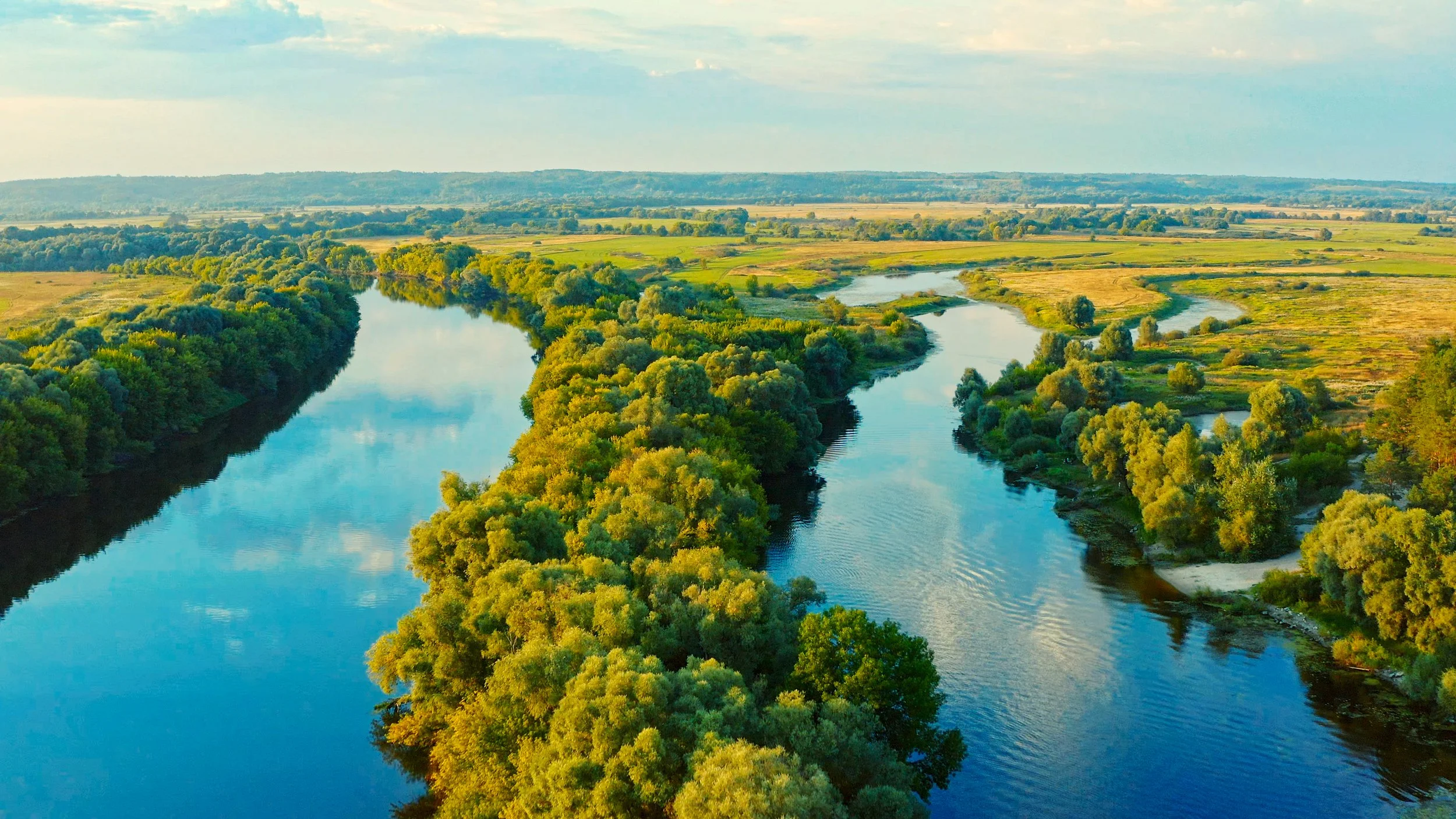
Managing water resources effectively requires precise data and actionable insights. At Terralynx, we provide high-resolution LiDAR and aerial mapping solutions that empower drainage contractors, water management professionals, municipalities, and engineering firms to make informed decisions, optimize planning, and execute projects with confidence.
How We Improve Your Projects
-
Collaborative, Customized Approach:
We recognize that no two projects are the same. Thatʼs why we work closely with you to develop tailored approaches, from troubleshooting to advanced data processing, ensuring the insights you receive are accurate, actionable, and aligned with your project goals.
-

Fast & Cost-Effective Data Collection:
Our aerial mapping cover hundreds of acres in hours, reducing survey costs while increasing efficiency and accuracy.
-

Generate Accurate Topographical Maps:
Our imaging workflow provides detailed 3D terrain models, eliminating the need for costly and time-consuming ground surveys.
-

Optimize Water Flow & Drainage Design:
Get the data you need to create efficient drainage layouts, prevent flooding, and improve irrigation planning.
-

Support Infrastructure & Hydrological Modeling:
Use our detailed elevation models to conduct flood risk assessments, land grading, and stormwater planning with confidence.
-
Pinpoint Drainage Issues with High-Precision LiDAR:
Quickly identify terrain variations, surface flow patterns, and drainage inefficiencies to improve water movement, prevent pooling, and reduce maintenance and repair needs.
-

Seamless Integration with Industry Software:
Our LiDAR data is fully compatible with Trimble Ag, Topcon, AutoCAD, and Civil 3D, ensuring a smooth transition from data collection to project execution.
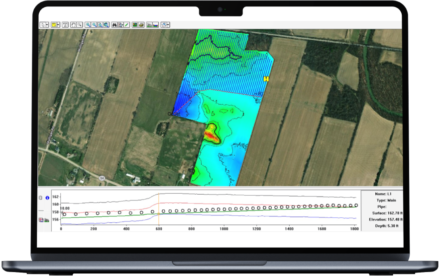
Real-World Impact: Case Study
Drainage Design in Under 24 Hours
In a recent project, an 85-acre field was fully mapped in just minutes using Terralynxʼs LiDAR-equipped aerial platform. Our advanced sensors penetrated dense vegetation to generate a bare-earth digital elevation model (DEM). Within hours, we processed and exported the data directly into Trimble Ag Software, enabling a complete drainage system design in less than 24 hours.
Eliminated the need for on-foot surveys, reducing field labor and time by over 80%
Delivered design-ready outputs at a fraction of traditional survey costs-estimated net savings of over $2,000 compared to traditional methods
Provided high-resolution elevation data that improved design precision, reduced rework, and accelerated implementation
Added value through faster turnaround, improved planning accuracy, and increased operational confidence
Why Water Management Experts Choose Terralynx
Comprehensive, End-to-End Solutions: From data collection to analysis and reporting, we provide a one-stop seamless experience.
Industry-Leading Data Accuracy: Our LiDAR solutions provide high-density elevation models that surpass traditional surveying methods.
Multi-Technology Integration: We combine multispectral, LiDAR, high-resolution imagery, and AI-driven tools to generate the precise data you need, tailored to each project's objectives.
Proven Track Record of Success: With years of industry experience, trusted partnerships, and successful large-scale projects, we provide reliable, high-quality data to support critical infrastructure, drainage, and environmental initiatives.

Start Your Next Project with the Right Data
Founded in 2017 to help farmers improve crop management, Terralynx has since become a trusted partner for across industries. Based in Ontario, Canada, our teamʼs expertise spans many backgrounds, including agriculture, aerospace, and technology (hardware and software).